What Is a Digital Twin? Applications in Smart Urban Planning & Sustainable Cities
- The Essence of Digital Twin in Urban Planning
- Distinguishing Digital Twins from Traditional 3D Models
- Applications of Digital Twins in Smart Urban Planning
- Specific Application Areas of Digital Twins in Urban Environments
- Challenges and Opportunities for Implementing Digital Twins in Vietnam
- Digital Twins and the Future of Vietnamese Cities
- FAQ About Digital Twins in Urban Planning
The Essence of Digital Twin in Urban Planning
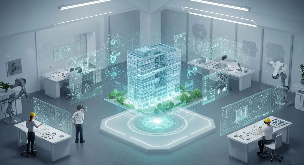
A Digital Twin is a dynamic virtual replica of a physical object, process, or system, continuously updated in real-time. In urban planning, it serves as a comprehensive digital model, accurately reflecting the city’s current state, including infrastructure, transportation, environment, and civic activities, enabling analysis, simulation, and forecasting.
Amidst rapid urbanisation and escalating demands for efficient management and operation, the concept of a Digital Twin emerges as a revolutionary tool. It is not merely a static digital copy but a dynamic entity, constantly fed data from the real world via sensors, IoT systems, and other data sources. This digital replica provides urban planners, managers, and stakeholders with profound, holistic, and real-time insights into every facet of the city.
Simply put, a city’s Digital Twin is a detailed, living virtual replica, mirroring everything from buildings, roads, and utility systems (electricity, water) to traffic flow and socio-economic activities. The two-way connection between the digital twin and its physical counterpart allows for continuous data flow, creating an intelligent feedback loop. This means any change in the real city is instantly updated on the digital twin, and conversely, analyses and simulations performed on the digital twin can be applied to optimise or adjust real-world operations.
The advent of Digital Twins is intrinsically linked to advancements in digital technologies, particularly simulation, Artificial Intelligence (AI), Machine Learning (ML), cloud computing, and the Internet of Things (IoT). As cities grow increasingly complex, generating millions of data points per second, Digital Twins offer a unified platform for collecting, processing, analysing, and visualising this vast amount of data. They transform raw data into valuable information, supporting evidence-based decision-making rather than relying on guesswork or traditional experience.
Distinguishing Digital Twins from Traditional 3D Models
While both employ spatial modelling, Digital Twins significantly surpass traditional 3D models in dynamism and real-time data connectivity. A 3D model is typically a static representation, depicting the physical form and structure at a specific point in time, primarily for visualisation or initial design purposes. In contrast, a Digital Twin is a dynamic system, integrating operational data, sensor feeds, and other non-physical elements, enabling scenario simulation, performance analysis, and behavioural prediction.
The core difference lies in dynamism and interactivity. A standard urban 3D model might display the shapes of buildings, road networks, or parks. However, it cannot indicate current traffic flow on a specific road, ambient temperature in an area, a building’s energy consumption, or the operational status of the drainage system. A Digital Twin, by integrating IoT data and other sources, can provide this detailed, up-to-the-minute information.
For instance, a 3D model might show the location of a substation. However, the Digital Twin of that substation would include data on current load, operating temperature, maintenance history, and even predictions of potential overload based on weather forecasts and electricity demand models. This capability allows managers to make proactive decisions, such as adjusting loads or scheduling maintenance before an incident occurs.
Furthermore, Digital Twins can simulate not only current states but also future scenarios. Planners can use a Digital Twin to test the impact of constructing a new road, implementing a new traffic policy, or responding to a natural disaster like flooding or an earthquake, all without posing any risk to the actual city. The results of these simulations provide deep insights, aiding in optimal planning and management decisions.
Applications of Digital Twins in Smart Urban Planning
Digital Twins serve as the foundational platform for smart cities, enabling efficient, sustainable, and citizen-centric urban management, operation, and development. They support data-driven decision-making, resource optimisation, and enhanced quality of life.
In urban planning, Digital Twins offer significant advantages. Firstly, they provide a powerful tool for comprehensive analysis and assessment of the urban status quo. Planners can use the digital replica to better understand how urban systems interact, thereby identifying bottlenecks, areas needing improvement, and new development opportunities. For example, by analysing real-time traffic data and simulating congestion scenarios, planners can propose solutions to optimise traffic flow, enhance public transport systems, or plan new routes.
Secondly, Digital Twins facilitate scientific and transparent planning decision-making. Instead of relying on traditional forecasting models with limited accuracy, planners can use the digital replica to run detailed simulations of the impact of various planning decisions. For instance, they can simulate the effect of constructing a new residential area on existing infrastructure (electricity, water, waste treatment), traffic density, and environmental factors like air quality. This helps in risk assessment, design optimisation, and ensuring sustainable development.
Thirdly, Digital Twins are potent tools for smart urban operational management. Once a plan is approved and implemented, the digital replica continues to function as a virtual control centre. Managers can monitor the performance of infrastructure systems (power grids, water supply, wastewater treatment, public lighting), detect potential issues early, and coordinate response activities quickly and effectively. For example, in case of a power outage, the digital twin can help identify the cause, predict the affected area, and plan for the fastest possible restoration of power.
Finally, Digital Twins enhance citizen experience and participation in urban development. Through intuitive interfaces, citizens can access information about planning, ongoing projects, and city operations. They can also provide feedback on urban issues, fostering a two-way interaction between authorities and residents, promoting transparency and accountability.
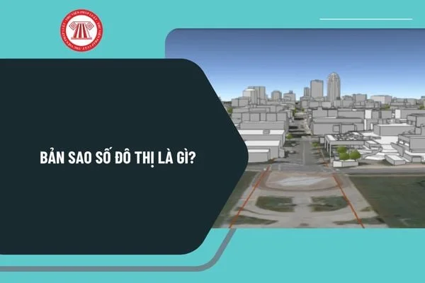
Specific Application Areas of Digital Twins in Urban Environments
The applicability of Digital Twins in urban settings is vast, spanning numerous domains from technical infrastructure to social and environmental management.
- Urban Planning and Development: Simulating the impact of new planning projects (residential areas, industrial zones, public facilities) on existing infrastructure, environment, traffic, and public services. Assessing land use efficiency, optimising building density, and green space allocation.
- Smart Traffic Management: Simulating traffic flow, predicting congestion, optimising traffic signals, planning public transport routes, managing parking, and supporting autonomous vehicles.
- Energy and Resource Management: Monitoring and optimising electricity and water consumption, managing distribution networks, integrating renewable energy, forecasting demand, and planning supply.
- Environmental Management: Monitoring air and water quality, simulating the impacts of climate change (floods, droughts), planning disaster response, and managing waste and pollution sources.
- Utility Infrastructure Management: Monitoring the operational status of power, water, telecommunications, and drainage systems; detecting early signs of damage; and planning maintenance and repairs.
- Public Security and Safety: Simulating emergency scenarios (fires, terrorism), planning evacuation routes, coordinating response forces, and monitoring area security.
- Building and Complex Management: Optimising energy usage, HVAC systems, and lighting; managing security and maintenance; and enhancing user experience.
A practical example can be seen in Singapore, a pioneer in creating a comprehensive national Digital Twin, known as “Virtual Singapore.” This project provides a dynamic 3D platform, integrating data from various sources, enabling urban planners and managers to simulate development scenarios, assess the impact of new policies, and improve city operational efficiency. Specific applications include analysing solar accessibility for buildings to optimise solar panel installation or simulating noise propagation for rational planning of residential areas and public facilities.
Challenges and Opportunities for Implementing Digital Twins in Vietnam
The implementation of Digital Twins in urban planning in Vietnam, particularly in major cities like Ho Chi Minh City, faces numerous challenges but also presents promising development opportunities.
Challenges:
- High Initial Investment Costs: Building a Digital Twin platform requires significant investment in technological infrastructure (sensors, networks, servers, software), data collection and processing, and workforce training.
- Data Integration and Standardisation: Urban data is often fragmented, inconsistent in format and quality, and sourced from various agencies. Integrating and standardising this data to create an accurate and reliable digital replica is a complex challenge.
- Security and Privacy: Digital Twins collect and process large amounts of sensitive data regarding infrastructure, economic activities, and resident life. Ensuring cybersecurity, protecting personal data, and preventing unauthorised access are critical factors.
- High-Quality Human Resources: A team of experts with deep knowledge in planning, IT, data science, AI, and urban management is needed to build, operate, and effectively leverage the Digital Twin platform.
- Legal and Institutional Framework: Clear legal regulations are required for collecting, sharing, and using urban data, as well as mechanisms for coordination between state management agencies and private entities in implementing and operating Digital Twins.
Opportunities:
- Enhanced Management and Planning Efficiency: Digital Twins provide powerful tools for data-driven decision-making, optimising resource utilisation, minimising waste, and improving urban operational efficiency.
- Promoting Sustainable Smart City Development: They help cities better respond to climate change, manage resources effectively, improve environmental quality, and enhance residents’ quality of life.
- Attracting Investment and Economic Development: A well-managed, transparent city capable of adopting advanced technologies becomes more attractive to domestic and foreign investors, driving economic growth.
- Increased Community Participation: Providing a platform for citizens to access information, participate in decision-making processes, and monitor government activities, fostering a more open and transparent city.
- Potential Application in High-End Real Estate Projects: Developers can use Digital Twins to simulate and optimise the design and operation of urban areas and mixed-use complexes, adding value for customers and improving asset management efficiency.
In Ho Chi Minh City, the application of Digital Twins could commence in key areas or large-scale projects. For instance, in real estate, new urban area projects or mixed-use complexes could build digital replicas for efficient operational management, energy optimisation, technical system maintenance, and enhancing residents’ living experience. Developers like NALUX Development can consider integrating Digital Twin elements into their project planning and management, not only to optimise operations but also to create a sustainable competitive advantage in the market.
Digital Twins and the Future of Vietnamese Cities
Digital Twins are no longer a futuristic concept but are gradually becoming a reality, shaping the future of cities worldwide. For Vietnam, embracing and applying this technology is an inevitable step towards building smart, sustainable, and regionally competitive cities.
In the future, Digital Twins will become increasingly sophisticated, integrating deeper with technologies like AI, machine learning, predictive analytics, and virtual/augmented reality (VR/AR). This will enable cities not only to understand the present but also to accurately forecast the future, thereby making strategic, long-term planning and management decisions. Simulations will become more detailed and realistic, allowing for the effective testing of complex policies and multi-faceted impact assessments.
For real estate investors and affluent families in Ho Chi Minh City, understanding Digital Twins and their application potential in urban planning is crucial. It not only helps in evaluating the development potential of areas and projects but also serves as a key factor in choosing a place to live or invest. Projects planned and managed on a Digital Twin platform are likely to operate more efficiently, be more sustainable, offer higher added value, and provide a better quality of life for residents.
Pioneering developers like NALUX Development can consider adopting Digital Twin principles in their projects, from the planning and design stages through to operation. This not only helps optimise costs and enhance energy efficiency but also creates a smart, convenient, and safe living environment for residents. Transparency in information and interactive capabilities through digital platforms will also be significant advantages, attracting customers who value technology and convenience.
Overall, Digital Twins promise to be an indispensable tool in shaping Vietnam’s future cities – smart, efficient, sustainable, and human-centric. Proactively learning about, researching, and gradually applying this technology will be key for managers, investors, and citizens to collectively build a better urban future.
FAQ About Digital Twins in Urban Planning
1. How can a Digital Twin help solve traffic congestion in Ho Chi Minh City?
A Digital Twin allows for detailed simulation of real-time traffic flow, analysis of congestion causes, and testing of various solutions (adjusting traffic signals, changing lanes, planning new bus routes) before practical implementation. This aids in making optimal decisions for the transportation system, reducing travel time and pollution.
2. Is the cost of implementing a Digital Twin too high for Vietnamese cities?
The initial cost may be high, but the long-term benefits in management efficiency, resource savings, and improved quality of life are substantial. Implementation can be phased, starting with key areas or priority projects, using technologies appropriate to budget and needs.
3. How can data security and privacy be ensured when using a Digital Twin?
Robust security layers for the system, data encryption, strict access controls, and adherence to personal data protection regulations are necessary. Collaboration with cybersecurity experts is essential.
4. How can a Digital Twin assist real estate investors?
Investors can use a Digital Twin to assess project potential, simulate operational efficiency, optimise design, forecast cash flow, and manage assets post-investment. It facilitates accurate investment decisions and risk mitigation.
5. What is the future of Digital Twins in Vietnam’s urban planning?
Digital Twins will become a core tool in smart urban planning and management, helping to build efficient, sustainable cities that can adapt to climate change and improve residents’ quality of life. The technology will become more sophisticated, integrating further with AI and other emerging technologies.

NALUX Urban Research & Development Division
A dedicated team of market data analysts, biophilic architects, and luxury real estate legal appraisers at NALUX Development Corporation. All insights and forecasts are founded on verified master planning data and independent field audits.